The home, probably a tall tenement building, was nestled among the palatial residences of dukes, aristocracy, and other wealthy members of the government, including Henry Vane (the Elder and Younger). The palaces are named for York, Northumberland, Durham, Suffolk, Bedford, and Savoy. Whitehall Palace, nearby, was a royal residence of King Charles I. Other maps show that the houses were surrounded by walled formal gardens and orchards that stretched toward the River Thames.
Clicking on the images below should enlarge them for more detail.
 |
| The image is from an engraving by Claes Visscher, a Dutch artist who may never have visited London, but created his panorama from maps and drawings. The engraving was published in 1616, during William Dyer's childhood. I've cropped out the center and east panels of the long panorama, to focus on the Dyer surroundings. Image: public domain. |
 |
| In this image, the Greene's Alley location of the Blackborne/Dyer home is covered by the west end of the Embankment riverside park and the Embankment "Tube" station. Image: Google Maps 2010. |
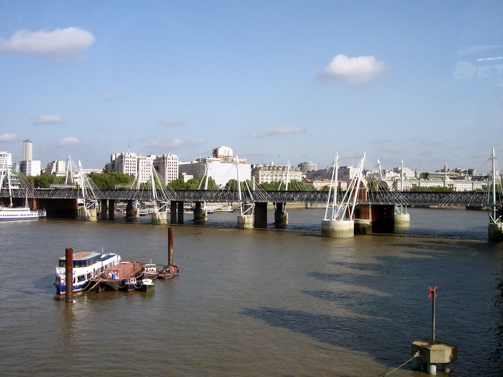 |
| This image is of the pedestrian and rail bridge at the Embankment, which I took from the London Eye observation wheel. Where the green trees of the Embankment meet the bridge abutment at the left is probably where the Blackborne/Dyer house was in the 17th century. Image: Christy K Robinson 2006. |
 |
| The Embankment on the Thames, from the railway/pedestrian bridge. This is quite close to the spot where Greene's Alley would have been. London's city financial district is in the center background. Image: Christy K Robinson 2006. |
 | |
| 1658 Newcourt map of London, zoomed into the St Martin-in-the-Fields parish where the Dyers were married, and lived from 1633-1635. The SMITF church at that time was a 12th-century (or even earlier) building with a square tower that was rebuilt and remodeled in 1542, 1606, and 1710, in the neoclassical style we see today. Notice the "New Exchange" written on the street north of Durham House. That was a high-end shopping district where Walter Blackborne and later William Dyer kept a haberdasher shop. The Mews, now occupied by Trafalgar Square, was a home for hunting birds at one time, then converted to stables for government horses. Charing Cross, in the three-way intersection south of the Mews, was torn down by iconoclasts, and later rebuilt. |

Christy K Robinson is the author of five books:
- We Shall Be Changed (2010)
- Mary Dyer Illuminated (2013)
- Mary Dyer: For Such a Time as This (2014)
- The Dyers of London, Boston, & Newport (2014)
- Effigy Hunter (2015)